Showing posts with label scenic drive. Show all posts

Thursday, February 21, 2013

Mapping Sedona


A map can be a key to adventure.
I'm delighted! A couple days ago, I learned that Rio Nuevo Publishers released the Sedona Map and Guide, a project that I worked on throughout 2012. This feels a little like sending a child off to college, then realizing when they come home for a visit that they've grown into someone remarkable. In a sense, I’ve worked on this project the entire 25 years I’ve lived in Arizona, collecting experiences and memories, seasons and stories. 

I realize that a number of people today think that maps will go the way of dinosaurs, thanks to GPS technology. But I love maps the same way I love books, as ink-on-paper talismans that hold potential riches of story and adventure. Of course, no piece of paper can truly represent the fullness of being in the landscape, but I think we came close with this project.

The main talent behind this map is Bronze Black, a Flagstaff designer/illustrator and river guide who produced a similar project, his Grand Canyon Superguide. In addition to trail information, Bronze incorporated my text and dazzling photography from Larry Lindahl, George H. H. Huey, and others, photographers whose work has been featured on the pages of Arizona Highways magazine. Dave Jenney, Caroline Cook, and the supremely talented folks at Rio Nuevo Publishers shepherded the map through the final stages, making sure it was not only accurate and useful but also an object of beauty.

I’d like to think that our enthusiasm for getting to know Sedona via mountain biking (in Bronze’s case) and hiking (my case) shines through. We wanted to convey Red Rock Country as an experience—not merely a beautiful landscape to admire from afar, but as a place of hidden canyons, fascinating history, wildflowers and wildlife, and awe-inspiring geology—all accessible and waiting to be explored.

Even if a two-dimensional rectangle of paper can’t hold the entire spectrum of Sedona, I hope this map will become a key for people to unlock their own experiences.

Sunday, June 3, 2012

Take a Hike: Cathedral Rock


Cathedral Rock Trail is a classic Sedona hike.

Cathedral Rock, a monumental red sandstone formation in the center of the Sedona area, is one of the most-photographed scenes in Arizona. The classic view is along Oak Creek from the west, at Crescent Moon Ranch and Red Rock Crossing. (Scenic Red Rock Loop Road leads to this day-use area, a great spot for a picnic or a gentle stroll along the creek.) 

But it’s possible to climb to the very heart of the Cathedral’s sandstone spires, beginning from the formation’s northeast side. Some people say that the spires are where Cathedral’s vortex energy is concentrated. If you’re curious about Sedona’s vortex sites, a hike here is the perfect opportunity to see for yourself if all the buzz about Sedona’s special energy is mere hype or a genuine phenomenon.

For the trailhead, drive south on State Route 179 from its intersection with State Route 89A. At 3.5 miles, turn right at Back O’ Beyond Road and continue a half-mile to the parking area on the left. If you’re afraid of heights or unsteady on your feet, think twice about making this moderately difficult hike. Though it’s a mere 1.5 miles round-trip, it’s steep, with ledges and toeholds in some places. In places, the trail travels over bare slickrock; the forest service has marked the route with numerous rock cairns.

Once you arrive at the top, you can enjoy the views of the Chapel area to the east. Look for the two red rock spires known as The Nuns. To the west, Oak Creek’s meandering route is marked by a green band of trees that turn gold in autumn. A short scramble south leads to the base of the tall spire in the center of Cathedral Rock, known as The Mace. Do you feel the vortex vibe? Or is it simply the exhilaration of making an invigorating hike to an amazingly beautiful place?

Thursday, May 10, 2012

Grand Canyon’s Wild Side: The North Rim


Grand Canyon's Point Imperial on the North Rim

Road trippers, buckle your seatbelts: National Park facilities on Grand Canyon’s North Rim are due to open next week. (Officially, the park’s North Rim is open May 15–October 15, but Mother Nature has the final say.) This news is sweet relief for desert dwellers. Phoenix temperatures are expected to top 100 again by the end of the week, while on the North Rim it’s 30 degrees cooler.

Higher than the South Rim by 1,400 feet and shaded by boreal forests of spruce, fir, and aspen, the North Rim can receive more than a 100 inches of snow each winter, forcing the closure of State Route 67 and park facilities. By mid-May, the snow is gone, meadows and aspen are greening, and Grand Canyon Lodge throws open its doors to welcome visitors.

Only one out of ten park visitors make it to this side of the canyon. Though it’s only 10 miles away from the South Rim’s Grand Canyon Village as the raven flies, to get to the North Rim takes five hours by car or shuttle or at least two days of hiking.

For the lucky few who venture here, that means natural quiet, fresh pine-scented air, and a relaxed pace. Many of the North Rim’s scenic highlights are strung like gems along the paved Cape Royal Road, which travels 20 miles across the Walhalla Plateau. Even along this popular scenic drive, trails are seldom crowded. (One of my favorites, short but sweet Cliff Springs Trail, starts near the end of the road.)

The North Rim’s most popular trail, the North Kaibab, leads into the canyon. Several other trails wind through rim-side forests, where wildflowers linger through summer. If you plan to explore beyond the pavement, you’ll want a high-clearance vehicle and a good map. Be aware that gravel and dirt roads in the neighboring Kaibab National Forest can be muddy into June. Check weather and road conditions before starting out. For the latest announcements from Grand Canyon, visit the park service’s web site.

Welcome to Grand Canyon’s wild side!

Sunday, April 22, 2012

The View From Sedona

Oak Creek, Sedona, Arizona
Among the pitfalls of writing for a living is that you can find yourself in an echo chamber, spending too much time in front of a computer, cut off from your subject and isolated from your audience. Even if you’ve never needed to supplement your writing income with a day job (lucky you!), getting out in the world can bring a fresh perspective, or at least a few good anecdotes.

One of the most entertaining encounters I had while working on Sedona’s busy retail strip was with the guy looking for The View. He burst into the gallery a bit disheveled and out of breath. “Where’s the view?” he demanded. “People told me there was a view here.”

Bear in mind there are only three ways in and out of Sedona, each considered scenic routes. After a few questions, I learned that he had arrived via the Red Rock Scenic Byway, which winds between several monumental red sandstone formations, including Bell Rock, Courthouse Butte, and Cathedral Rock. If he didn’t spot a “view” along that route, I wasn’t sure I could help him.

I suggested a couple possibilities, somehow managing to refrain from adding the suggestion he get his vision checked. After he left, I realized it was his inner vision that that needed examining. Chances are, he had heard about Sedona from someone, and he traveled here with a particular vision in mind. For me, it was a lesson in how expectations can close us off from experience.

Expectations, familiarity, busy-ness—all these can cloud perception and separate us from the things we love, both people and places. When we take a vacation, we vacate our everyday lives. And when we travel with an open mind and open heart, we feel a renewed sense of discovery and enthusiasm. But we don’t need a plane ticket to make every day a discovery.

Today, plant a seed, smell a wildflower, enjoy the sun on your skin. Do something you’ve never done before, or try approaching something familiar as though you’re a traveler seeing it for the first time. Open your eyes and heart to the majesty of your familiar earth home. As T.S. Eliot wrote: “[T]he end of all our exploring will be to arrive where we started and know the place for the first time.”

Happy Earth Day!

Friday, March 30, 2012

Sedona's Top 3 Scenic Drives

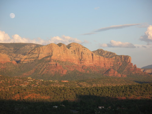
The Mermaid at moonrise, from Red Rock Loop Road

Honestly, you can find stirring scenery in Sedona, Arizona, without getting in a car and driving around. But spring is here, complete with wildflowers, busy birds, and blue skies, and one of the best ways to take it all in is with a scenic drive. Here are my favorites: 

1. Red Rock Scenic Byway
This 7.5-mile “All American Road” is Sedona’s main gateway, State Route 179 from I-17 through the Village of Oak Creek. Officially, Red Rock Scenic Byway begins at milepost 302, where SR 179 crosses Dry Beaver Creek. Like many “creeks” in Arizona, this one is a rocky wash except during spring runoff, but even when dry it’s delineated by tall cottonwoods and white-trunked Arizona sycamores. A couple miles further, the new forest service visitor center is an ideal place to stop to pick up trail maps and a Red Rock Pass, as well as take a long look at the panorama ahead. The view encompasses Bell Rock, Courthouse Butte, and other brilliantly colored cliffs.

In recent years, SR 179 has been widened to a divided four-lane highway, with scenic pullouts and ample trailhead parking. The designated scenic byway ends at milepost 310, near the celebrated Chapel of the Holy Cross, but the scenery doesn’t quit. SR 179 passes along Sedona’s “gallery row,” including the creekside shops at Tlaquepaque, before ending at “the Y,” a double-roundabout intersection with SR 89A.

2. Red Rock Loop Road
Travelers entering Sedona from the west via SR 89A can turn right at milepost 368 for Lower Red Rock Loop Road, the beginning of a scenic 7-mile long side trip that skirts the base of 4,899-foot Scheurman Mountain before circling back to rejoin the highway. Though a short section of the loop is gravel, the route is accessible to most passenger cars, depending on weather.

The loop road edges Oak Creek, where some of the Sedona area’s first settlers lived. The Schuerman homestead is preserved at Red Rock State Park, at mile 3 along the loop. The park offers great creekside birdwatching and easy hiking trails with great views. covered sandstone cliffs.

Don’t miss the side-trip to Crescent Moon Ranch picnic area and Red Rock Crossing. At the stop sign, turn onto Chavez Ranch Road and follow the signs. The spires of majestic Cathedral Rock soar above and reflect in the clear waters of Oak Creek, an inspiring scene said to be the most photographed place in Arizona.

The loop road climbs a series of hairpin turns before passing Red Rock High School and rejoining SR 89A. Dirt pullouts are good places to stop for breath-taking elevated views of Cathedral Rock and Courthouse Butte.

3. Boynton Pass Loop
A visit to Sedona’s backcountry, where you’ll find hiking trails and prehistoric ruins, begins by turning north on Dry Creek Road from SR 89A. Turn left at the next two T-intersections. (A right at the second T leads to the acclaimed Enchantment Resort and trailhead parking for Boynton Canyon, considered a vortex site.) The Boynton Pass Road (FR 152C) is paved to the Bear Mountain/Doe Mesa trailhead. Depending on weather conditions, most passenger cars can handle the dirt road beyond, which ends at FR 525, Red Canyon Road. Turn right, and you’ll come to a fork. To the left is the bumpy 4.5-mile route to Honanki ruins (high-clearance recommended). The 2-mile gravel road on the right leads to Palatki Heritage Site, home to a 900-year old dwelling built into the cliffs of Red Canyon by the Sinagua Indians. With a reservation, you can hike to the ruin overlook or take a guided tour through rock alcoves marked with thousands of pictographs and petroglyphs. Palatki and nearby Honanki are maintained by Coconino National Forest. To complete the loop after leaving Palatki, stay on Red Canyon Road for 10 miles until it connects with SR 89A.

BONUS: Schnebly Hill Road
Schnebly Hill Road winds up to the Mogollon Rim, following a historic route that early settlers used to reach Flagstaff, then a trip of 2-4 days. The views are amazing, but after the first mile, the dirt road is primitive and rocky. Unless you have a high-clearance vehicle, it’s best to see this one by signing up for a jeep tour or on foot via the Munds Wagon Trail, a 4-mile hiking trail that parallels the road. The trailhead has ample parking, picnic tables, and panoramic views of Uptown Sedona. Whether behind the wheel or on foot, stop to admire the Cow Pies, mounds of red sandstone (another vortex, say some) with outstanding views that take in Sedona and the Verde Valley. Schnebly Hill Road begins at the Oak Creek Bridge roundabout, next to Sedona Pottery.